Weather Alert
NWS IN CLEVELAND, OH, Apr. 2020 — What to expect:
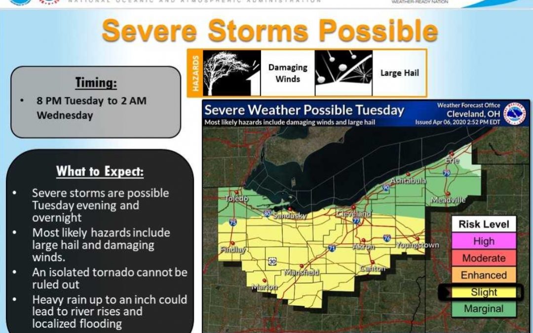
- Several rounds of showers and thunderstorms are possible which will bring large hail, damaging wind, and heavy rain.
- The first round of showers and thunderstorms will occur tonight through tomorrow morning.
- The primary threat for this round is heavy rain, although hail and gusty winds are also possible.
- Confidence is high on the timing and location of this initial round of storms.
- Areas most at risk will be west of I-77 and north of US-30.
A break in storm activity is expected throughout much of the day Tuesday (late morning through the afternoon). The second round of showers and thunderstorms will occur Tuesday evening and overnight. Confidence remains low in storm coverage and location, but storms that do develop are likely to become severe, capable of large hail, damaging winds, heavy rainfall, and an isolated tornado. Areas most at risk include much of Northern Ohio.
Posted by Dan Starcher, public communications specialist for the Wayne County government.