428 West Liberty Street Wooster, Ohio 44691 Lower Level County Admin Building
(330) 287-5420 | Mon-Fri: 7:30AM – 4:30PM
The Planning Department is a branch of the County Government that serves under the direction of the Wayne County Board of Commissioners.

Land Use
Planning Commission
The Planning Commission is an eleven-member board consisting of three County Commissioners or their alternates, and eight members appointed by the County Commissioners.
Technical Review Committee
The first step for submission to the Planning Commission is review by the Technical Review Committee (TRC). The TRC is a one stop shop for subdivision review, consisting of: Wayne County Planning Department, Wayne County Health Department, Soil & Water Conservation District, Wayne County Building Codes Department, Wayne County Engineer and the Map Office.
TRC Application | Technical Review 2023 Meeting Schedule | Minor Subdivision Application Process | I submitted the TRC Application! Now what?
Subdivision Regulations
- Minor Subdivision Application Checklist
- Minor Subdivision Application Process
- Major Subdivision Application Checklist
- Access Management – Effective August 1, 2023
- WayneOnward Plan Appendix 11-26-2019

The Wayne County Planning Department is responsible for the enforcement of the Subdivision Regulations for the unincorporated areas of Wayne County. Variances, Major Allotments and Common Access Drive proposals are reviewed by the Wayne County Planning Commission at their regularly scheduled meetings.
Zoning
There is no zoning in the unincorporated areas of Wayne County except Chippewa Township so properties in all those other areas have no zoning; However, there are county subdivision regulations, health, building code, floodplain and soil and water regulations that must still be followed.
Chippewa Twp Zoning CONTACTS: Chippewa Twp Zoning Inspector: Jeremy Porter (cell) (330) 351-1050 or the twp office: (330) 658-2112. Email: jeremy.porter@chippewatwp.com
City of Orrville
City of Wooster
City of Rittman
Apple Creek (village)
PH: (330) 698-5462
Burbank (village)
Zoning Map: Zoning Map.pdf
Webpage: Village of Burbank, Ohio
Congress (village)
Email: congressvillage@gmail.com
PH: (419) 846-3490
Creston (village)
Zoning Map: Zoning- Village of Creston
Webpage: Village of Creston, Ohio
Dalton (village)
PH: (330) 828 – 2221
Doylestown (village)
Webpage: Doylestown, Ohio
PH: (330) 658-2181 ext: 1111
Fredericksburg (village)
Webpage: Village of Fredericksburg, Ohio
Marshallville (village)
PH: (330) 855-2491
Mount Eaton (village)
PH: (330) 359-5452
Shreve (village)
Webpage: Shreve, Ohio
PH: (330) 567-2601
Smithville (village)
Zoning Map: Zoning | The Village of Smithville
Webpage: The Village of Smithville
West Salem (village)
Webpage: West Salem Village
Floodplain Review
The Wayne County Planning Department is responsible for the enforcement of Floodplain Resolution for the unincorporated areas of Wayne County.
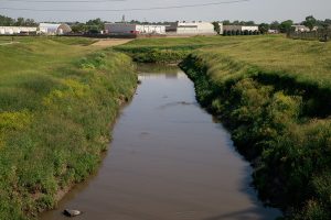
What is a Floodplain?
The floodplain is that part of the stream that conveys the excess water of a stream or river during a flood event. Improper development within the floodplain can cause significant loss of property and possibly of life. The NFIP (National Flood Insurance Program) regulation requires, prior to any development in a regulatory floodplain, that a permit be issued.
Additional Information:
Farmland Preservation
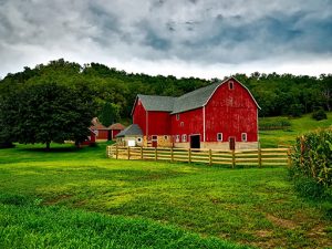 Wayne County is blessed with some of the best farmland in the world. Our farmland provides a host of environmental benefits and is the factory floor for the local economy. As part of our commitment to the Agricultural Community, Wayne County is pleased to offer the following programs:
» Ag Security Areas (ASAs)
Landowner(s) with at least 500 contiguous areas of unincorporated farmland can opt into ASA for 10 years. ASA’s are voluntary; locally controlled; incentive-based, and respect private property rights.
ASA’s provide certain benefits to farmers, including protecting against non-farm development, assembling a critical mass of land to help keep farming viable, and can provide tax exemptions for new investments in structures used exclusively for agricultural purposes.
To begin the process, Watch this Video, download the ASA Fact Sheet, and begin to reach out to neighboring farms. Our Farmland Preservation Specialist will assist you with the application process.
For more information: State of Ohio ASA Application | Wayne County Policy and Procedures | ODA Program Information | ASA Tax Benefits | Tax Exemption Application | Farm Tools Brochure
Read The Oasis in the Desert: Thoughts on protecting Wayne County’s Farmland by Ron Becker
– – – – – – – – – – –
Agricultural Easements
Landowners who wish to permanently protect their farm from development can do so with an agricultural easement. An easement is a permanent and legally-binding restriction which forever limits the use of the land to predominantly agricultural activity. The land remains in private ownership, and can be sold or passed along as a gift at any time, but the restriction prohibiting development stays with the land. An easement can be placed on the land now, or specified in the owner’s will.
Paid Easements: Wayne County is a local sponsor for the Ohio Department of Agriculture’s (ODA) Clean Ohio Local Agricultural Easement Purchase Program (LAEPP). LAEPP provides funding to farmland owners for placing an agricultural easement on their property up to 75% of the appraised value of a farm’s development rights, with a max of $2,000 per acre. This is a competitive program open each year January – March.
Click Here for the 2024 LAEPP Pre-Screening Questionnaire
Donated Easements: Landowners can permanently protect their property by donating development rights to the ODA’s Agricultural Easement Donation Program (AEDP) or a private organization such as Killbuck Watershed Land Trust (KWLT)or the Western Reserve Land Conservancy. This type of easement does not provide compensation, but can have fewer restrictions and will receive tax benefits.
– – – – – – – – – – –
» Ohio Agricultural Easement Donation Program (AEDP)
An agricultural easement is a permanent, legally binding restriction, which forever limits the use of the subject land to predominantly agricultural activity
This program is about donating an agricultural easement. Doing so may meet your goals as a landowner and a family to preserve the farm you have built and ensure that the land will be in private ownership and agricultural production for generations to come.
Read: Ohio Agricultural Easement Donation Program
– – – – – – – – – – –
» Clean Ohio Local Agricultural Easement Purchase Program (LAEPP)
Wayne County is a local sponsor for the Ohio Department of Agriculture’s Clean Ohio Local Agricultural Easement Purchase Program (LAEPP). LAEPP provides funding to farmland owners for placing a permanent agricultural easement on their property up to 75% of the appraised value of a farm’s development rights, with a max of $2,000 per acre. This is a competitive program open each January – March.
Read more about the LAEPP. Landowners who want to submit an application must work with a Local Sponsor. The Wayne County Commissioners can be a Local Sponsor for Wayne County landowners. Contact the Farmland Preservation Specialist at AgPlan@WayneOhio.org or call us to learn more.
» AG Success Team
The Ag Success Team (AST) is a network of farmers, food and farm supply chain businesses, educational institutions, nonprofit organizations, capital providers, economic development organizations, and local government with diverse perspectives, deep knowledge and experiences, strong community connections, and a passion for protecting and preserving Wayne County’s food and agricultural systems.
The AST was formed in 2004 by the Commissioners and local volunteers to help retain and expand Wayne County’s agricultural sector. Their role is to advocate for all forms of agriculture, ensure there is land available to farm, and make sure that issues central to agriculture are represented in discussions about economic development.
The mission….
The mission of the Wayne County Ag Success Team is to secure Wayne County farms and farmland for future generations by serving as a covening resource that supports the many initiatives that sustain and add value to our agricultural community. Our goals are:
- Promote and strengthen the viability of farms by fostering a vibrant and diverse food and farm economy.
- Educate the public about the important role agriculture plays in our community.
- Support agricultural systems and production practices that leverage our natural resources while protecting the environment and health of the people who live here.
- Identify holistic approaches that help farmers and make farming an appealing and attainable way of life.
Click here to sign up for our newsletter!
Download our Farm Tools Brochure or email AgPlan@WayneOhio.org for any questions about any of these programs.
EVENTS
Rated "M" for Manure
WHEN: 12/05/2023
Solar Webinar Series
Available Now
Community Development
Fair Housing Program
 For Fair Housing questions:
County inquiries may call (330) 621-8038
For City of Wooster call (330) 263-5200 x300
The Fair Housing Program provides information on tenant / landlord rights and responsibilities, a place to report cases of housing discrimination, information on requesting repairs, rights to support animals, and dealing with mold or bedbugs.
Wayne County partners with Community Action Wayne/Medina and Community Legal Aid to support tenants and landlords. For Fair Housing questions in Wayne County outside of Wooster call: (330) 621-8038. Wooster residents call: (330) 263-5200 extension 300.
For more information about Community Legal Aid, call (800) 998-9454 or go to communitylegalaid.org
ADDITIONAL INFORMATION:
- Community Legal Aid: What to do if you’re worried about an eviction
- U.S. Environmental Protection Agency: A brief guide to mold, moisture and your home.
- Community Action Wayne/Medina
Rural Enterprise Zone
The Planning Department works with the Rural Enterprise Zone program for the unincorporated areas and the villages in the County. Compliance with the tax incentive agreements is reviewed annually. A list of current Wayne County tax incentive agreements is available at the State of Ohio web site. Questions about the program and the county policies should be directed to the Wayne Economic Development Council, 330-264-2411.
Community Housing Impact Program (CHIP))
 The CHIP Program funds major home repairs that preserve affordable housing. Both rental and owner occupied properties may be eligible.
The program is a partnership between Wayne County, the City of Wooster, the City of Orrville and the Wayne Metropolitan Housing Authority who administers the program. To learn what repairs may be funded and who may qualify for assistance, call (330) 264-2727.
CBDG
The Wayne County Commissioners usually receive monies every two years for Community Development Block Grant (CDBG) Community Development Allocation funds (formally known as the CDBG Formula program) from the State’s Ohio Small Cities Program. This grant allocation is HUD federal funding and is administered by the State. All projects submitted must qualify by meeting the HUD National Objective of benefitting an area and/or persons that are considered to be at least 51% Low to Moderate Income (LMI) as determined by the 2010 Census. Or, if your community has an approved LMI survey that was conducted after June, 2020 it must be submitted when you turn in an application. LMI surveys are only valid for five (5) years. If you are unsure of your LMI status, please contact us for clarification.
In previous years, CDBG funds have been made available for various infrastructure and public service projects within the villages, the townships, Orrville and Rittman. Only 15% of the County’s total allocation can be applied toward public service projects.
In addition to the Allocation Grant program there are three competitive programs that are rated and funded at the State level and they include:
- Neighborhood Revitalization program,
- Downtown Revitalization program, and
- Critical Infrastructure program
Wayne County Transit
![]() Wayne County Transit is a joint project of Community Action Wayne/Media and the Stark Area Regional Transit Authority (SARTA). WCT provides low cost, curb-to-curb shared ride public transit Monday thru Saturday from 6:00 a.m. to Midnight. Click HERE for information on how to use WCT and a downloadable registration form.
Wayne County Transit is a joint project of Community Action Wayne/Media and the Stark Area Regional Transit Authority (SARTA). WCT provides low cost, curb-to-curb shared ride public transit Monday thru Saturday from 6:00 a.m. to Midnight. Click HERE for information on how to use WCT and a downloadable registration form.
New! November 08, 2023 WCT PRESS RELEASE
Revolving Loan Fund
Wayne County works with the Ohio office of Economic Development and the Wayne Economic Development Council financing loans to local businesses. The loans finance investments creating or retaining permanent jobs for low and moderate income residents. Loan payments from businesses are paid back to the fund and can be loaned out again for further economic development.
 Supplemental Information
Main Phone Number: (330) 287-5420
Jennifer Kiper, Director
Email: jkiper@WayneOhio.org
PH: (330) 287-5423
—
Stephanie Featheringill
Land Use Planner
Email: sfeatheringill@WayneOhio.org
PH: (330) 287-5426
TRC, subdivision regulations, floodplain, CDBG & CHIP Questions
—
Jessica Eikleberry
Farm Land Preservation Specialist
Email: jeikleberry@wayneohio.org
PH: (330) 287-5422
ASA & Tax Abatement and Agricultural Conservation Easements programs and Enterprize Zone Questions
—
Economic Development Coordinator – OPEN
For Economic Development Questions – please reach out to WEDC @ 330-264-2411
OTHER RESOURCES
Federal Emergency Management Agency (FEMA) has floodplain maps online and enables searches by an address for the applicable floodplain map.
The Ohio EPA (OEPA) provides information on both water and sewage treatment facilities.
The Ohio Department of Natural Resources (ODNR) provides information on the communities with floodplain programs and their contact information.
U.S. Army Corps of Engineers – Regulations for waterways and wetlands as well as permit information for our area can be found at the U.S. Army Corps of Engineers website for the Huntington District Office.
Web-based Underground Mine Locator – A web-based underground mine locator is available online. The underground mine locator will identify any known abandoned underground mine by street address or by interactive map.